Overview
What is GeoTools?
GeoTools is an add-on program to help you boost your productivity with AutoCAD / Map and BricsCAD. It helps you work smarter, faster and eliminates various bottlenecks you face using the plain CAD platform. GeoTools was written with mapping, GIS and Civil / Survey users in mind initially but now there are enough commands in this program for it to be useful and relevant to just any CAD user.
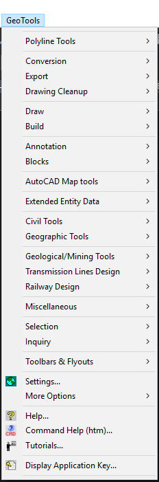
Tool Categories
|
Polyline Tools |
Conversion Tools |
|
Export Tools |
Drawing Cleanup Tools |
|
Draw Tools |
Build Tools |
|
Annotation Tools |
Blocks Tools |
|
AutoCAD Map Tools |
Geographic Tools |
|
Geological / Mining Tools |
Transmission Lines Design |
|
Railway Design Tools |
Miscellaneous Tools |
|
Selection Tools |
Inquiry Tools |
|
Toolbars & Flyouts |
Settings |
|
More Options |
|
|
|
|
GeoTools organizes its feature tools in different functional categories as shown above.
General Modes of Operation - User Interface
GeoTools commands can be selected from either the pull-down menu, the ribbon menu, toolbars, right-click context menus or simply typed on the command line.
- All GeoTools command start with GT_
- All Geological/mining tools start with GEOL_
- All Transmission Tower design commands start with TR_
- All Railway Drafting/Design start with RL_
GeoTools pull-down menu
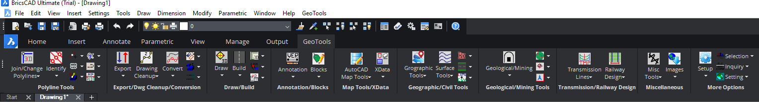
GeoTools ribbons
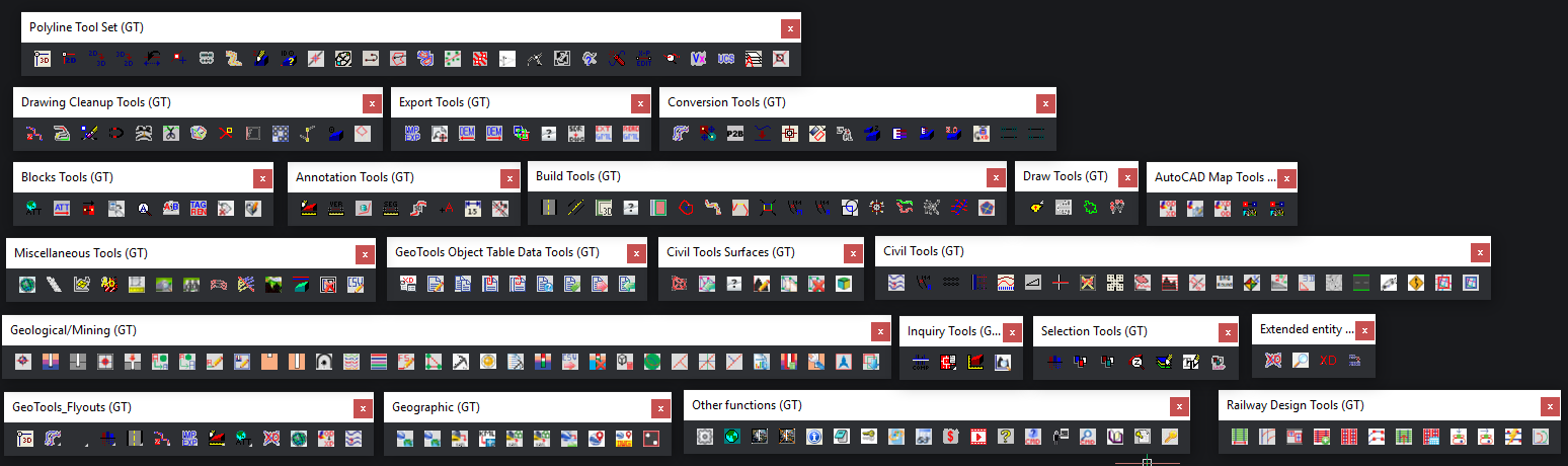
GeoTools icons
Using command-line to key in the command name
Command-line names for each of the GeoTools commands are shown in the status bar at the bottom of your screen when you highlight a GeoTools command in the pull-down or toolbar menu. The command names are also shown in this manual in front of the command description.
Compatibility with Scripts
Many GeoTools commands are designed to function both with a dialog box interface (DBI) as well as command line interface (CLI) for automated scripts processing. Dialog box driven command display equivalent command line options when called through a script. To find out how each command will operate in command-line, you can turn on the command line mode in GeoTools -> Settings command. If you find any command you want that is not yet working in script mode, please let us know and we will fix that for you on priority mode.
Results of command operations
GeoTools commands which operate on a set of selected objects produce desired results and these results are always placed in active selection set. The active selection set can be accessed using the "previous" or "p" option during any Select objects: prompt. The last processed GeoTools selection is preserved in memory until it is overwritten by the next GeoTools command or if other commands process the active selection and modify/delete the objects contained in them
Object selection methods
Many of the GeoTools commands require a user selection of objects to be made. GeoTools provides several methods by which this selection can be built. Each time an object selection is required, GeoTools displays a generic dialog box (see below) labeled "Build Selection Set".
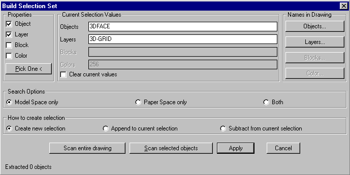
[Properties] section
Objects can be filtered on the basis of their types or layer / block names or a combination where applicable. Depending on which of these are checked, the appropriate selection mode is applied. You can graphically indicate the object property to be used by picking one "sample" object by clicking on the Pick One button at the bottom of the Properties section.
[Current Selection Values] section
Once you have selected which property to use, you can specify the values for these named objects in two ways - they can be manually typed into the edit boxes under this section labeled Objects, Layers and Blocks or can be selected from a list of available names in the current drawing document by choosing the appropriate buttons in the Names in Drawing section.
If you have to manually type in more than one name, separate them with a comma in between. Wildcards can be used to specify names.
You can choose to apply the current selection criteria (filters) to the entire drawing or to selected objects only. Accordingly, the Scan entire drawing or Scan selected objects
option must be used.
Apply
Exits the dialog box by placing the current selection in the active [previous] selection set. If another GeoTools command has invoked this dialog box, then the command continues after the selection is made. If it is called independently through the GeoTools-->Selection-->Build Selection Set (GT_ MAKESEL) command, the resulting selection set will be placed as active [previous] selection and can be accessed by using the "p" option in response to the Select Objects prompt.
Model Space and Paper Scale
GeoTools commands are tested and designed to work with model space objects only. Many of the GeoTools commands may work correctly with paper space objects also but this is not tested extensively and not supported by the developers. If a GeoTools command is not working as stated, it could be because of some paper space objects in the selection. If this is suspected, check the appropriate boxes in the Search Options section to ensure that your selection searches for objects from model space only.